
November 15th, 2019
Friday

THE POWER
OF MAPS
Using Maps to Tell a Story
On Wednesday we learned about one way to use maps to tell a story. Maps can be tools to communicate not only geographic information, but a narrative about experiences or phenomena.
On our last day of Geo Week activities, we want students to explore the ways they can express their creativity through maps. Many things in everyday life are informed by place - in fact, place matters in everything that we do. In what ways can maps help us to express and record our Florida memories?
"Maps are more than diagrams that help you navigate from point A to point B. They are windows into information that allow us to explore our world, understand it better, and engage with it more productively. Maps can spark our curiosity, provide insight, spur us to action, and help us build solutions for a better world.
This lesson explores five maps, which may inspire you to reconsider what maps can do and what you can do with them."

CLASS STARTER:
EARLY BIRD
Split the class into teams. On a piece of paper, ask them to write down some things we use maps for in everyday life. Try to name as many as possible within 5 minutes.

TODAY'S LESSON


The following lesson on ArcGIS Story Maps was created by ESRI, and can be found on their official website along with other Story Map lessons and resources.
Maps are windows to information for exploration and discovery. They are interactive data repositories. They are a storytelling medium and a decision-making tool.
You can use maps to explore and discover almost any place.
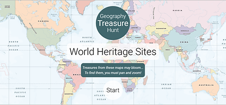
2. Click Start. A clue is shown at the top of the map for a UNESCO
World Heritage Site.
3. Navigate the map to try to locate the site. When you get close enough,
a pin and label appear.

Angkor Wat is a temple complex in Cambodia, built in the twelfth century.
3. Don’t click Next. Zoom in further to explore the site up close.
At a certain zoom extent, the map changes to show a satellite image.
You can see the grounds of Angkor Wat and the wide rectangular moat
that surrounds the temple.

This lesson was authored by ESRI for learn.arcgis.com.
